| Column label | Column description |
|---|---|
| Island | Island name |
| PlotID | Unique numeric identifier for each plot |
| Study | Brief name of study |
| Plot_area | Plot area in m2 |
| Longitude | Longitude of plot in decimal degrees; WGS84 coordinate system |
| Latitude | Latitude of plot in decimal degrees; WGS84 coordinate system |
| Year | Year in which plot data was collected |
| Census | Numeric identifier for each census |
| Tree_ID | Unique numeric identifier for each individual |
| Scientific_name | Genus and species of each individual following TPL v. 1.1 |
| Family | Family of each individual following TPL v. 1.1 |
| Angiosperm | Binary variable (1 = yes, 0 = no) indicating whether an individual is classified as an angiosperm following APG III |
| Monocot | Binary variable (1 = yes, 0 = no) indicating whether an individual is classified as a monocot following APG III |
| Native_Status | Categorical variable (‘native’, ‘alien’, ‘uncertain’) indicating alien status of each individual following Wagner et al. (2005) |
| Cultivated_Status | Binary variable (1 = yes, 0 = no, NA = not applicable) indicating if species is cultivated following PIER |
| Abundance | Number of individuals (all = 1) |
| Abundance_ha | Abundance of each individual on a per hectare basis |
| DBH_cm | Diameter at 1.3 m (DBH) for each individual; NA indicates that size was not measured, but was classified by size class |
Introducing data we’ll work with
Introducing the data
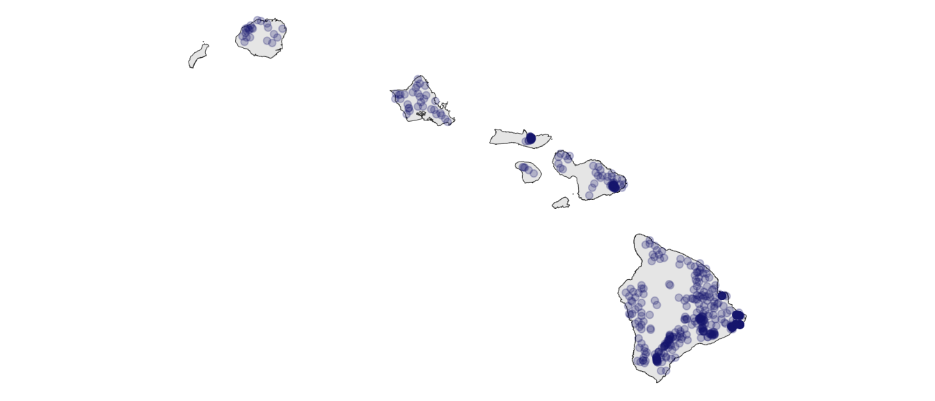
We will use the OpenNahele forest inventory plot data (Craven et al. 2018)
Introducing the data
- Open as in open source, open access
- Nahele as in forest ma ka ʻōlelo Hawaiʻi
What does using ʻōlelo Hawaiʻi in the name indicate?
Introducing the data
We will also use data from
- the Hawaiʻi Climate Data Portal (McLean et al. 2023)
- a data publication by Craven (2019)
These data have metadata
README_for_OpenNahele_Tree_Data.txt
These data have metadata
README_for_plot_climate.txt
| Column label | Column description |
|---|---|
| PlotID | Unique numeric identifier for each plot |
| lon | Longitude of plot in decimal degrees; WGS84 coordinate system |
| lat | Latitude of plot in decimal degrees; WGS84 coordinate system |
| evapotrans_annual_mm | Actual annual evapotranspiration in mm |
| avbl_energy_annual_wm2 | Annual available energy in W/m^2 |
| cloud_freq_annual | Annual cloud frequency in days/year |
| ndvi_annual | Normalized Difference Vegetation Index |
| rain_annual_mm | Annual rain fall in mm |
| avg_temp_annual_c | Annual average temperature in celsius |
These data have metadata
README_for_hii_geo.txt
| Column label | Column description |
|---|---|
| PlotID | Unique numeric identifier for each plot |
| lon | Longitude of plot in decimal degrees; WGS84 coordinate system |
| lat | Latitude of plot in decimal degrees; WGS84 coordinate system |
| hii | Human impact index |
| age_yr | Geologic substrate age in years before present |
| elev_m | Elevation in meters |
Working with the data
We will not go into visualizing and numerically describing the data just yet—that will be saved as exercises for getting (re-)acquainted with R.
Working with the data
Biocultural dimensions
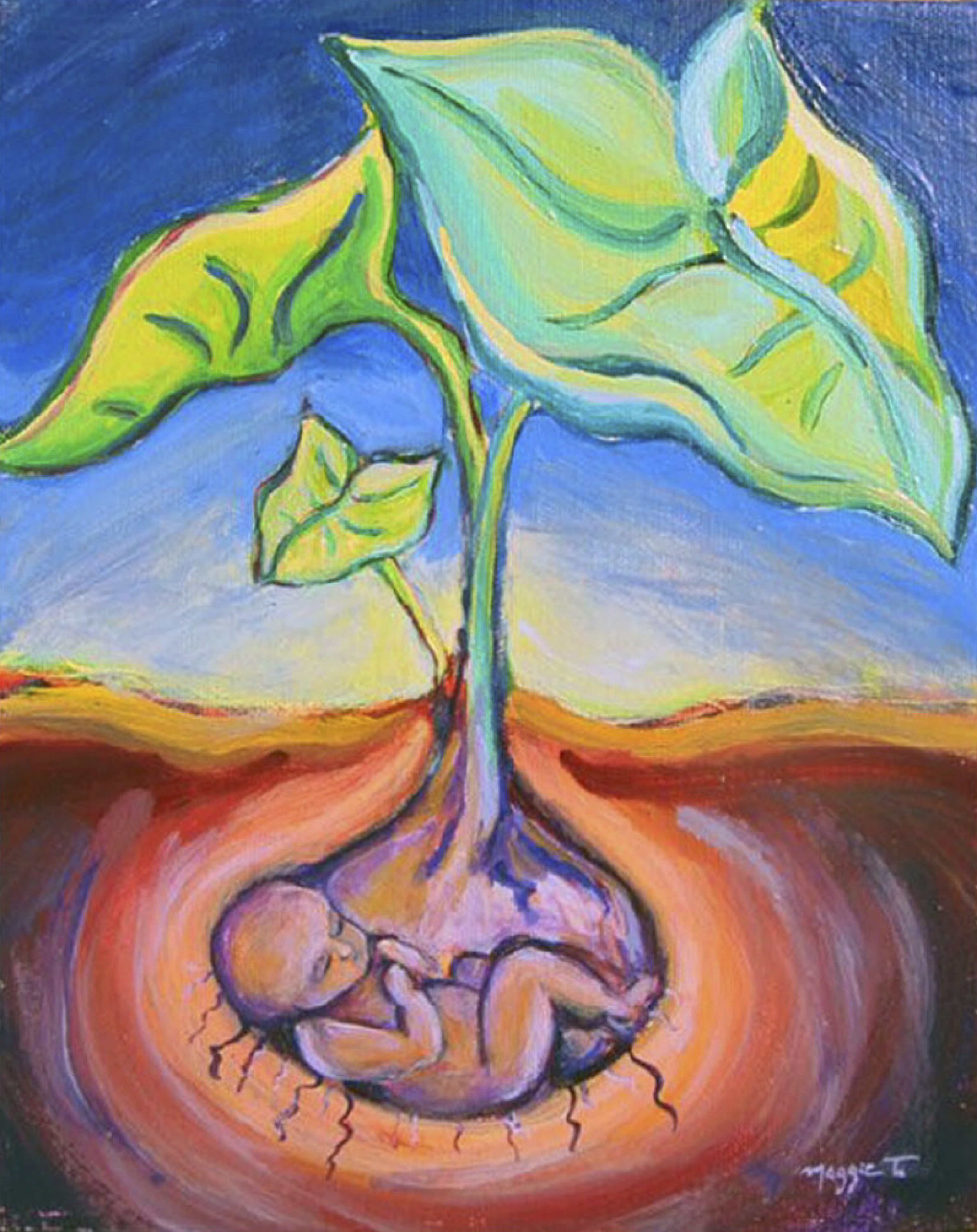
- Plants are kin
- Lāʻau lapaʻau and ethnobotanical connections to plants
- ʻŌiwi geographies including wahi pana and different categories of wao (e.g. wao akua)
Biocultural dimensions
Plants are kin: He Kumulipo + nā moʻolelo
Biocultural dimensions
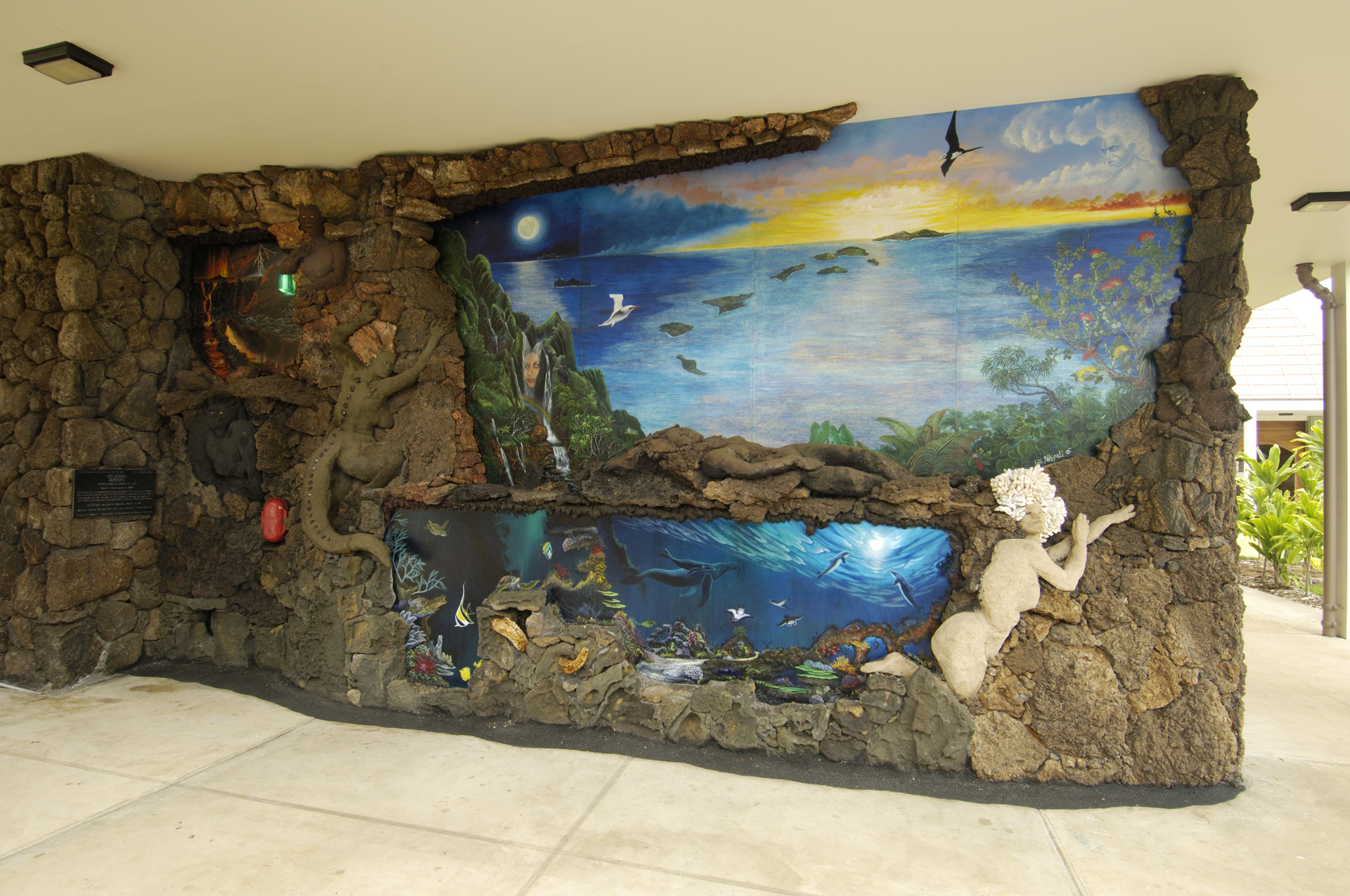
Lāʻau lapaʻau and ethnobotany
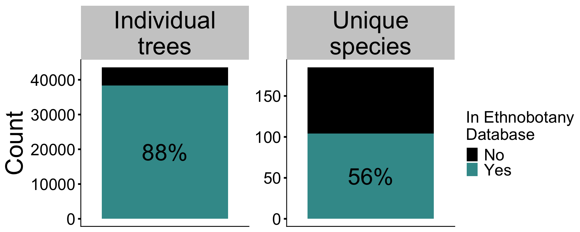
Hawaiian ethnobotany database built largely on the work of esteemed ʻŌiwi scholar Isabella Aiona Abbott (1992)
Biocultural dimensions
ʻŌiwi geographies
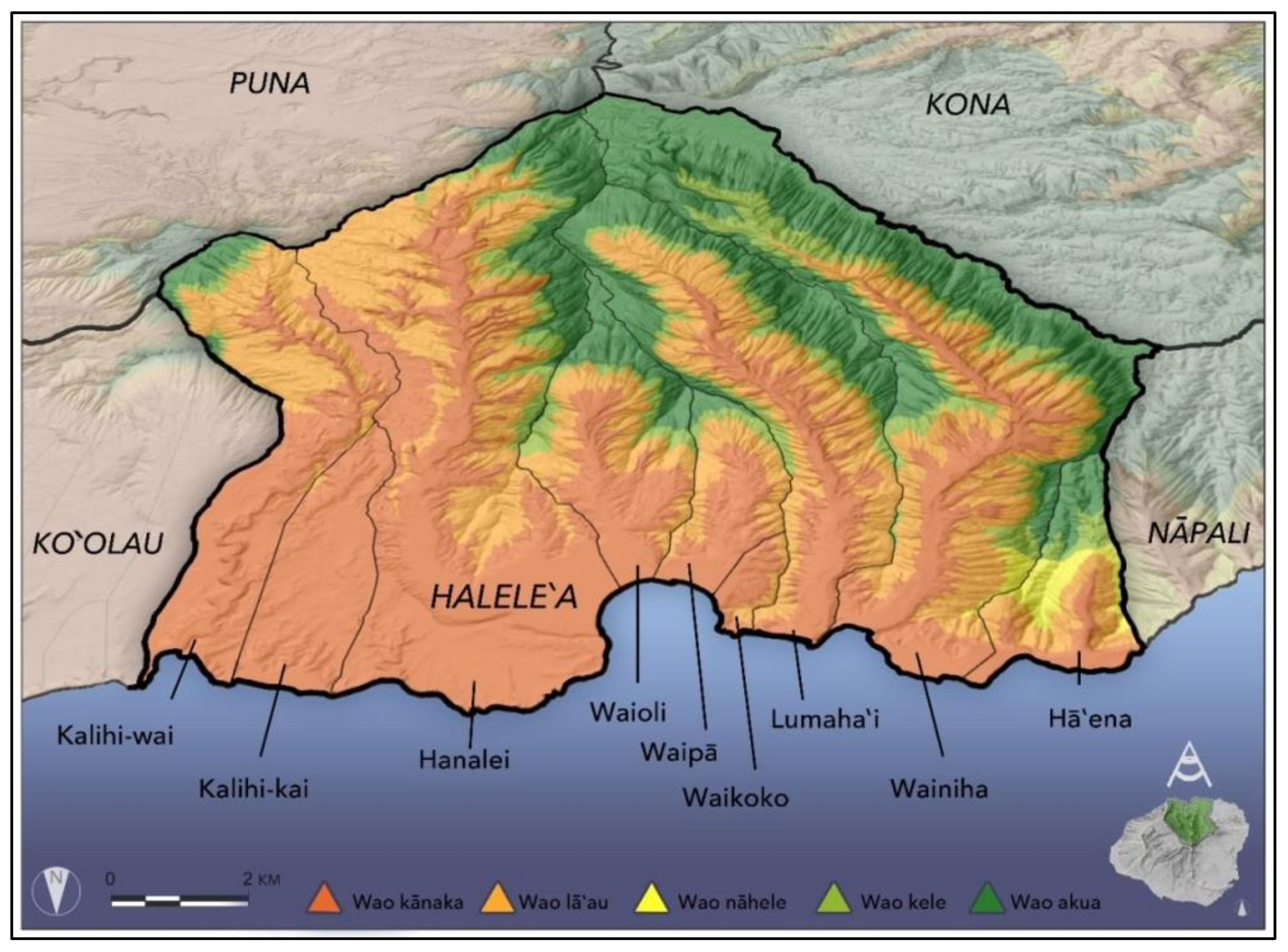
Wahi pana
Wao (70% of plots in wao akua?)
Ecological questions we’ll consider
First: A thought on whose knowledge counts as science
Ecological questions we’ll consider
- How have ecology and evolution played out across the multi-million year chronosequence of the pae ʻāina to shape differences in biodiversity across and within islands (investigated, e.g., by Gillespie 2016; Rominger et al. 2016)?
- How have human impacts and climatic variables modulated biodiversity (investigated, e.g., by Lim et al. 2021; Hutchins et al. 2023)
- Can data on human impacts and climate help us understand how invasive/non-native species occupy ecosystems (investigated, e.g., by Blackburn et al. 2011; Fortini et al. 2013)
References
Abbott IA. 1992. Lāʻau Hawaiʻi: Traditional hawaiian uses of plants. Bishop Museum Press.
Blackburn TM, Pyšek P, Bacher S, Carlton JT, Duncan RP, Jarošı́k V, Wilson JR, Richardson DM. 2011. A proposed unified framework for biological invasions. Trends in ecology & evolution 26:333–339. Elsevier.
Craven D. 2019, June. Dylancraven/hawaii_diversity: beta. Zenodo. Available from https://doi.org/10.5281/zenodo.3250638.
Craven D, Knight TM, Barton KE, Bialic-Murphy L, Cordell S, Giardina CP, Gillespie TW, Ostertag R, Sack L, Chase JM. 2018. OpenNahele: The open hawaiian forest plot database. Biodiversity Data Journal:e28406.
Fortini LB et al. 2013. A landscape-based assessment of climate change vulnerability for all native hawaiian plants. University of Hawaii.
Gillespie RG. 2016. Island time and the interplay between ecology and evolution in species diversification. Evolutionary applications 9:53–73. Wiley Online Library.
Gon III SM, Tom SL, Woodside U. 2018. ʻĀina momona, honua au loli—productive lands, changing world: Using the hawaiian footprint to inform biocultural restoration and future sustainability in hawai ‘i. Sustainability 10:3420. MDPI.
Hutchins L, Mc Cartney A, Graham N, Gillespie R, Guzman A. 2023. Arthropods are kin: Operationalizing indigenous data sovereignty to respectfully utilize genomic data from indigenous lands. Molecular Ecology Resources 25:e13822. Wiley Online Library.
Lim JY, Patiño J, Noriyuki S, Cayetano L, Gillespie RG, Krehenwinkel H. 2021. Semi-quantitative metabarcoding reveals how climate shapes arthropod community assembly along elevation gradients on hawaii island. Molecular Ecology 31:1416–1429. Wiley Online Library.
McLean J, Cleveland SB, Dodge M, Lucas MP, Longman RJ, Giambelluca TW, Jacobs GA. 2023. Building a portal for climate data—mapping automation, visualization, and dissemination. Concurrency and Computation: Practice and Experience 35:e6727. Wiley Online Library.
Rominger A et al. 2016. Community assembly on isolated islands: Macroecology meets evolution. Global ecology and biogeography 25:769–780. Wiley Online Library.
Winter KB, Beamer K, Vaughan MB, Friedlander AM, Kido MH, Whitehead AN, Akutagawa MK, Kurashima N, Lucas MP, Nyberg B. 2018. The moku system: Managing biocultural resources for abundance within social-ecological regions in Hawaiʻi. Sustainability 10:3554. MDPI.